Students were very enthusiastic about this project. Students really seemed to like the idea of gathering their own information which translated into them taking control of their own learning. Students also liked the idea of being able to verify their information by working cooperatively with other students. Of course, students were very excited about making their clay models! They did such a great job. The assessments I used included an observation checklist, questioning, journals and grading rubrics. These assessments allowed me to see student learning and provide feedback. I felt student learning was evident throughout the project, especially when I listened to groups using new words they had learned from their research.
The following are examples of student work. The first sample is a completed boundary chart. This sample shows student learning as all information is provided and all directions have been followed.

The following are pictures of students' models. These models are an example of student learning because students had to create models of land forms created a specific boundary types.

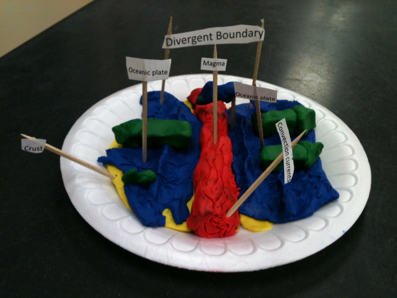
I really like that students include convection currents in their models! They really enjoyed this part of the lesson. Overall, I am very pleased with how the lesson was carried out, and I am very proud of my students!
I love these models! I spend a lot of time on this subject, and these models seem like a fun activity for students to participate in. Did you show students images of how they were to complete the models?
ReplyDeleteThe models are great!!! This seems like a very egaging and beneficial lesson for your students and has wonderful hands-on connections. One of my fellow middle school science teachers teaches standards along thses lines and I look forward to sharing this lesson with her. I think she could really benefit from these great ideas!
ReplyDeleteSarah: Thank you! My students were so proud to have their models selected for my project! Part of the inquiry lesson was to figure out what type of landforms occur at each boundary type. After researching all three types, students selected one boundary type and one landform. The did research and could find a picture to use to make their models. It was amazing how the students took this project and just ran with it!
ReplyDeleteMeg: Thanks! I hope your fellow teacher can use this idea. If she wants a copy of the boundary chart template, project explantion, and rubric let me know, and I will email them to you.
ReplyDeleteThe final products are amazing! It looks like the students really did understand plate boundaries and resulting landforms. Making models seem to be very engaging to students and powerful in allowing them to make connections. My first grader came home yesterday all excited about a clay model she made representing the earth and told me all about the crust, mantle and core. It's exciting to see the connections they make and their use of new vocabulary.
ReplyDelete